Canada Post has issued a series of stamps and collectibles, Dinos of Canada, on the theme of dinosaurs. Designer Andrew Perro incorporated several of my panoramas of Dinosaur Provincial Park and the Alberta Badlands. Illustrator Julius Csotonyi provided the terrifying dinosaurs.
Seventy-five million years ago this area was a lush semi-tropical swamp, teeming with turtles, crocodiles and dinosaurs. The park is now a UNESCO World Heritage Site, protected because it is a rich source of complete, fossilized dinosaur skeletons.
I hope you enjoy this nine-panorama tour.
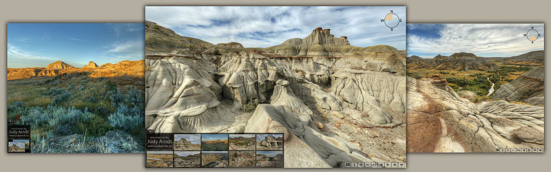
These panoramas were captured in the area around Drumheller.
View the introduction and map of panorama locations.

View the introduction and map of panorama locations.

The sun shone. The air was crisp and clear. We were lucky to visit the west coast of Vancouver Island during beautiful fall weather.
View the map and introduction to this virtual tour of thirteen panoramas.

Built in the days before there were highways or roads in this area, this trading post on the Fraser River offered supplies and freight services to prospectors looking for gold. It is located at the south end of the Giscome Portage, a trail that led overland to the headwaters of the Peace River and Arctic watershed.
View the map and introduction to this virtual tour of thirteen panoramas.

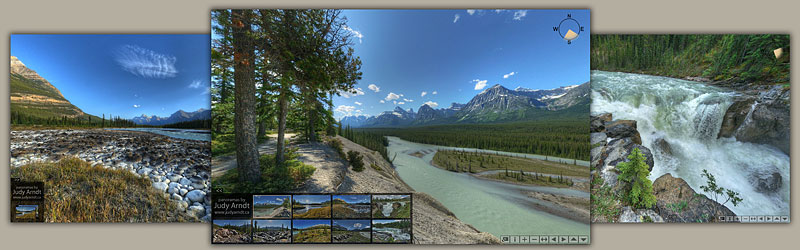
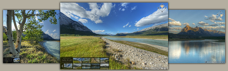
The massive, multi-peaked Mount Kerkeslin dominates the Athabasca Valley on the Icefields Parkway. Further south, we follow the Sunwapta Valley. Explore a rock slide and two waterfalls on this scenic route.
See a map of the area and links to the nine-panorama tour.
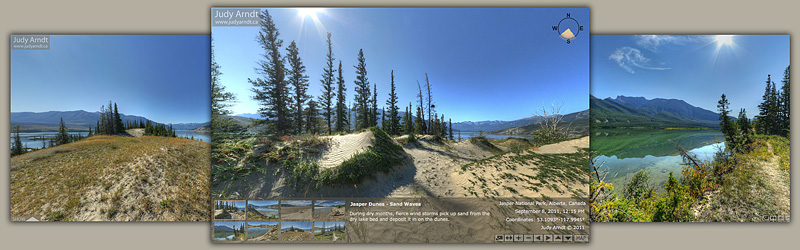
A wide, mountain-ringed valley of the Athabasca River is filled with sand, the remnants of an ancient ice-age lake. During dry spells, strong westerly winds sculpt the sand into long dunes.
I hope you enjoy this eight-panorama tour.
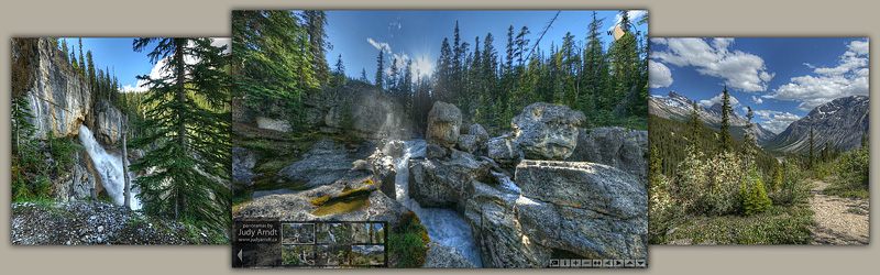
In the Sunwapta Pass of the Canadian Rocky Mountains, meltwater from glaciers feeds Nigel Creek. The steep, rocky terrain produces many waterfalls.
At Panther Falls, these clear, cold waters leap 180 meters (590 ft.) from a cleft in a high stone ledge.
Welcome to the six-panorama tour.
How did vertical layers of rock come to line the walls of Allstones Creek?
During the age of dinosaurs, 250 to 60 million years ago, layers of sand, clay and plant matter sank to the bottom of an ancient sea. Over millions of years, these sediments turned to sandstone, shale and coal. Then the immense upheaval of the advancing Rocky Mountains bulldozed these layers eastward and upwards over the bedrock, tilting them on edge.
In Allstones Creek, erosion has cut across these vertical layers, exposing coal-bearing seams on both sides of the canyon.
Allstones Creek flows into Abraham lake about 4km north of the Windy Point viewpoint. View the tour of six panoramas.

This tour of nine panoramas explores the changing light and weather in one area of the Kootenay Plains on the North Saskatchewan River. While viewing the tour, click the 'i' icon in the toolbar for information about each scene.
Some of Alberta's oldest trees live here, some of which are believed to be older than 1100 years. The rocks are old as well. A ridge of very hard Cambrian rock constricts the flow of the North Saskatchewan River, causing a whirlpool. I hope you feel youthful when viewing this four-panorama tour.

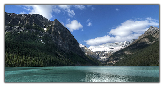
My collection of panoramas of the Canadian Rockies would be shamefully incomplete without the inclusion of the iconic Lake Louise in Banff National Park.
See the Galleries page for links to more panorama tours.